Google Earth and Arts and Culture
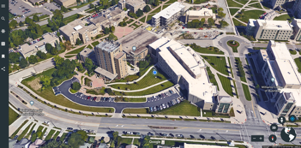
Google Earth allows you to "fly" over a virtual globe and view the Earth through high-resolution graphics and satellite images. It is greatly superior to static maps and satellite images. The images are detailed enough that in most populated areas you can clearly see your house, objects in your yard, and recognize your car parked along the street. A digital elevation model within Google Earth allows you to view the landscape in 3D.
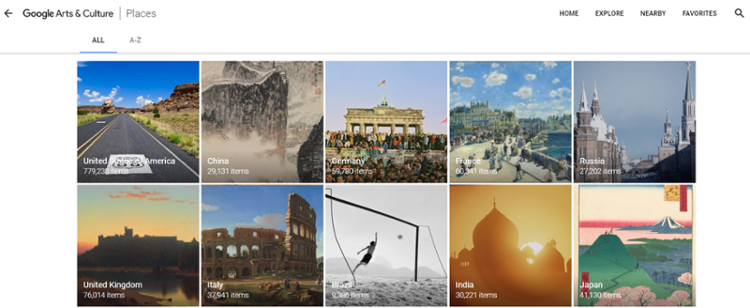
Google Arts and Culture allows you to meet the people, visit the places, and learn about the events that shaped our world. Discover collections curated by experts from the most famous museums. Be moved by stories depicted in thousands of photos, videos, manuscripts and artworks on every type of screen and in virtual reality. Find your favorite artworks, create your own collections and share them with friends using Google Arts and Culture.
Access Google Earth & Arts and Culture
Demonstration Videos
Videos
- Google Earth for beginners training video (7:20)
- Google Earth basics training video (15:45)
- Google Arts and Culture tutorial video (10:34)
- Google Arts and Culture - using selfie cam feature (2:30)
Guides
Where to Get Help
LMS Integration
Google Earth and the Arts and Culture apps can be linked out to from a Canvas course
Cost
Google Earth and the Arts and Culture apps are free to use
Account Required
A free Google account is recommend, but not required to use either apps